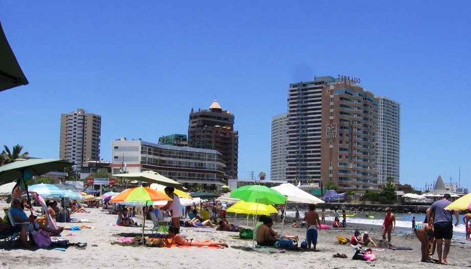
10/12/2010

Europe, Sept. 2010 - Madrid and Cáceres


This photo was taken on our next to last full day in Europe; we flew out at 7:30 AM two days later, ready to be home again after a month of hotels, restaurants, sore feet and…  a wonderful vacation.


We arrived in Madrid on September 3, roughly 24 hours after leaving home, and took a taxi to our hotel (H on the map) three blocks from the Puerta del Sol, the center of Madrid.  The Palace is to the left, and the Prado is at the lower right.


This is the Plaza de la Puerta del Sol, presently decorated by this huge movie ad, which is reportedly so profitable that renovation of the underlying building is progressing at a very leisurely pace.


The plaza and nearby pedestrian streets are full of elegant (and not so elegant) shops and are abundantly populated by fellow tourists and the accompanying pickpockets. We avoided one clumsy attempt, the only one on the trip.


Souvenirs are available.


The Plaza Mayor, lined with cafes, was our first stop after the Puerta del Sol. A little jet lagged, we slept through breakfast, but made up for it with a few tapas and a little wine.


Then, we walked down the Carrea San Jeronimo to this lovely fountian in the Plaza Canovas del Castillo….


…and from there to El Prado, where we saw the (depressing) El Grecos.  We soon adjourned to the fresh air and sunshine.


The first, and most impressive, of the many castles we visited was Madrid’s Palacio Real.  The rooms are lavish beyond description, financed with the incredible wealth Spain extracted from its American colonies.


Photos were not allowed inside, but Wikipedia provides us with some:


The throne room                                                   
The armory


The Almudena Cathedral, across the plaza from the palace.


After lunch we went to the Campo del Moro, the 19th century gardens behind the palace where Muslim ruller Alí Be Yusuf camped with his army in 1109.


And where I was reminded that abundant wine with lunch is probably not a good idea if an afternoon of walking is planned.


And walking is what we did most in Madrid; to El Prado, to the palace, to the train station…  and it became obvious that I needed a better pair of walking shoes.

And we went dancing at a club for adultos mayores near our hotel.  Unfortunately, there are no pictures.  We also ate.  


And we spent most of a day buying train tickets.  We planned to take the train to Lisbon, but wanted to travel during the day and stop somewhere along the way. But where?  There was a potential stop at Cáceres, capital of Extramadra. We found an internet outlet in the train station and looked it up.  I seemed a good choice, a city of a little less that 100,000, founded by the Romans in 25 BC. Wikipedia said:  “The old town (Ciudad Monumental) still has its ancient walls; this part of town is also well known for its multitude of storks' nests. The walls contain a medieval town setting with no outward signs of modernity.” 


The Extremadura landscape was dry, treeless and brown, but gradually became forested with trees that looked like oaks and in some areas were planted in rows.  We thought they might be cork oaks, and soon received confirmation, as we saw trees from which the bark had been removed revealing a reddish inner bark.


Plains of Extramadura 


Cork oaks


We arrived at our hotel in Cásares around noon, and headed up hill to the old city, where we had comida (AKA lunch, but the main meal of the day) on the plaza mayor (lower left). 


The plaza was full of open air restaurants, all offering a 10€ menú del dia, but restoration of the plaza floor was underway which limited the view.
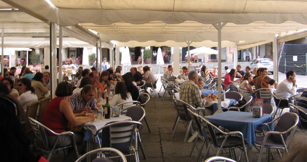


 We ate at several, our first Spanish meals meant for Spaniards and not necessarily for tourists.  The restaurants were very popular, almost full on a weekday.  (Food from the trip gets its own blog, see Eating Iberian). 


 The food was simple and good, a first course of gazpacho, salad, pasta, etc., followed by a second course of fish, calamari, or pork in various forms, with bread, house wine and dessert.  Here I have a pork stew, which came with fired potatoes.


From the Plaza, we enter the city through the main gate.


And proceed thought narrow streets to the center.


Alejandra went inside the Iglesia de San Francisco Javier and climbed to the top, where she took a photo of this stork’s nest.


The plaque says:  “Palace of the Toledo Moctezumas. This building symbolizes the mixing of European and American Cultures.  It was rebuilt in the 16th century by don Juan de Toledo Moctezuma (descendant of don Juan Cano de Saavedra, and Isabel de Moctezuma, daughter of the Aztec emperor) and doña Mariana de Carvajal and Toledo.”   Extremadura was the home of many of the conquistadores who conquered Mexico and Peru.


At the door of the Palacio Episcopal Alejandra met the caretaker.  Inside the doorway to the house on the left, occupied by a descendant of the Spanish nobility, we saw this patio. 


Twenty-first century Cáceres is also a pleasant city.  This parkway goes through the center of the business district.


From Cáceres, the only train to Lisbon left at 1:00 AM, but we arranged to spend half a night in our hotel, and left relatively rested.

Next:  Portugal

6/08/2010

Thanksgiving Gringo-Chileno

Thanksgiving, “El día de acción de gracias,” siempre ha estado mi día feriado favorito; combina familia, buena comida, el tiempo fresco de otoño, y es multicultural.   Todos mis paisanos lo celebran, de cualquier raza, étnia, religión o clase.  Naturalmente, es algo que quiero compartir con mi familia Chilena.  ¿Pero cuando?  En el norte se celebra en el tercer jueves de noviembre, pero aquí noviembre es primavera: Thanksgiving es la fiesta de la cosecha, de las hojas coloridas, de los primeros fuegos en el fogón. No puede ser en primavera.

Thanksgiving has always been my favorite Holiday, combining family, good food, crisp autumn weather and it’s multicultural.  All my countrymen and women celebrate it, regardless of race, ethnicity, religion or social class.  Naturally, it’s something I want to share with my Chilean family and friends.  But when?  In the north it is celebrated the third Thursday in November, but here November is spring:  Thanksgiving is the harvest festival, with colored leaves, and the first fires in the fire place.  It can’t be in spring.

Por eso, decidi que teniamos que crear un Thanksgiving Austral, y con el poder investido en mí como EL MARIDO DE LA REINA DE LA REINA, declaro que es el TERCER JUEVES EN MAYO (o cualquier día cerca que yo quiera).  Este año fue sábado, el 30 de mayo.

So, I decided that we have to create an Austral Thanksgiving, and with the power invested in me as THE HUSBAND OF  THE QUEEN OF LA REINA, I declare that it is the THIRD THURSDAY IN MAY (or whatever nearby day I choose).  This year it was Saturday, May 30.   

La Invitación / The Invitaticion:


Allgunos llegaron con disfraces. Sid dijo que sombrero Indio es Indio, no importa que tipo de Indio: y de todos modos es tan probable que hubiera Pakistaníes como Mi'kmaq en el primer Thanksgiving. Los otros gringos fueron peregrinos, con sombreros, y los Chilenos, mapuches con plumas.  Y Ellen hizo el tradicional pay de pecanas.

Some came in costume.  Sid said that an Indian hat was Indian, the kind of Indian was unimportant; and besides, there were just as likely to have been Pakistanis’ at the first Thanksgiving as Mi’kmak. The other Gringos were pilgrims, with hats, and the Chileans were Mapuches, with feathers.  Ellen made the traditional pecan pie.


Aceptaron Bourbon de moda antiguo para reemplazar los Pisco sours queridos. 
They accepted Burbon Old Fashoneds to replazar the beloved Pisco sours.


Las niñas comieron primero, con ayuda de mami.  The girls ate first, with help from Mom.


And then the adults ate their pumpkin soup and waited patiently for the arrival of the Turkey, etc.

Entonces los adultos comieron su crema de zapallo y esperaron con paciencia la llegada del pavo, etc.


Y al fin, El pavo.   And finally, the turkey.


Todo fue exitoso. El pavo (del parilla Webber) fue rico y no sobrecocido, y les gustaron (o por lo menos, comieron) las cosas exóticas: el relleno de pan de chuchoca, el “gravy” y la jalea de arandanos rojos (cranberries), la ensalada Waldorf, y el pay de zapallo y del pay de pecanas (que hizo Ellen).

It was a success.  The turkey (from the Webber grill) was delicious and not over cooked, and they liked (or at least ate) the exotic things: the cornbread stuffing, the gravy, the cranberry sauce, the Waldorf salad and the pumpkin and pecan pies (the latter contributed by Ellen).


Los Marcelos.

Los cocineros. The cooks.


Después regresamos al living donde las damas crearon obras de arte. 
Afterwards we adjourned to the living room where the ladies created works of art.


El arte esta expuesto.   The art on display.


Entonces, "Calabaza, Calabaza, cada quien a su casa."

Then, home.


2/14/2010

Iquique – January 2010

This summer’s vacation was a bit short. A had been head of pathology for less that a month with no backup and couldn’t take her full vacation so we decided to go north for a week – to Iquique; 1000 miles from Santiago and  200 miles south of the Peruvian border.

Why Iquique?  Mainly because we had never been there, or anywhere else in Chile’s norte grande, and needed a restful week.   And we knew it wouldn’t rain; it is in the driest region on earth. Average annual precipitation is .5 mm (.02 inches), but temperatures are moderate, the average high in the warmest month is 77°, in the coldest, 65°.
Iquique was founded in 1788 as a port for the salitre (sodium nitrate) mines in the Atacama Desert, then a part of Peru.  After the 1879 War of the Pacific, in which Chile defeated Peru and Bolivia, it became Chilean, and in the following 50 years brought great wealth to Chile as (mainly) foreign companies extracted salitre and sold it around the world as a source of nitrogen for fertilizers and munitions.  After the 1940s synthetic nitrogen largely eliminated the market for salitre, leaving Iquique dependant on fishing and fish meal processing, and on supplying copper and other mines in the Atacama.
Iquique’s isolated location on a narrow strip of sand between the Atacama and the Pacific Ocean, nicely captured in this photo, means that everything the city needs (except water, desalinated from the sea) must come in by truck, ship, or like us, by air in a three hour flight from Santiago.   To the east is the Atacama Desert.  Going south it’s 230 miles to Antofagasta, the next city; to the north, Arica is 200 miles.  
Click on photos to enlarge


Landing and on the taxi ride in from the airport (20+ minutes) the absence of vegetation is striking.  There is literally nothing green, alive, growing out of the earth, except where planted and watered by people.  Once in the city, there is more vegetation, but it is hardly verdant – landscaping is not one of the city’s strengths.


Our hotel, south of the city center and a block from the beach, was pleasant if unremarkable.


But it had an ocean view….  more or less


The old city center, now including a pedestrian mall leading to the plaza, is full of old wood-frame buildings dating to the 19th and early 20th century.

It includes a good small regional museum that covers Iquique’s culture history from the prehistoric Chinchorro people (and their mummies) to the salitre mining period and the region's indigenous Aymara people.


The Chinchorro mummies, dating to as early as 6000 BP, are the world’s oldest.


At the end of the mall is the Plaza, with the Club Croata and the Casino Española at the far corner.  The clubs were established by foreign mine owners and executives in the late 19th century.  There is also a British Union Club.


We had almuerzo in the ornate Casino Española,

       …followed by a little rest by the fountain.


And there is the beach.


*******

One of the highlights of a trip to Iquique is a tour of the salitre  offices and other sights of the Atacama.  From Iquique we climbed abruptly 1700+ feet or up to Alto Hospicio, Iquique’s low rent suburb, and on through the coast range at at altitude of 3800 feet, then down into the dry lake bed where the salitre was mined. 


Our first stop was at the Officina Santa Laura, just east of Humberstone on the map.  The mines were called “offices” because the first mining was done by independents who blasted through the hard caliche to mine the softer deposits below, which they brought to the offices for sale.  Later the offices became headquarters for mining and processing the sodium nitrate.


Officina Santa Laura, now with Humberstone, a UNESCO World Heritage Site, described as:


Humberstone and Santa Laura works contain over 200 former saltpeter works where workers from Chile, Peru and Bolivia lived in company towns and forged a distinctive communal
pampinos culture. That culture is manifest in their rich language, creativity, and solidarity, and, above all, in their pioneering struggle for social justice, which had a profound impact on social history. Situated in the remote desert Pampa, one of the driest deserts on earth, thousands of pampinos lived and worked in this hostile environment, for over 60 years, from 1880, to process the largest deposit of saltpeter in the world, producing the fertilizer sodium nitrate that was to transform agricultural lands in North and South America, and in Europe, and produce great wealth for Chile. Because of the vulnerability of the structures and because of the impact of a recent earthquake, the site was also placed on the List of World Heritage in Danger, to help mobilize resources for its conservation.

The salitre processing plant

...and administrators’ living quarters.


A short distance further on is Humberstone, here showing the company town plaza.


The workers quarters.


The swimming pool.


The theater.


From Humberstone we turned south on the Pan American Highway, passed through Pozo Almonte (which in spite of being one of the driest places on earth, has some truck gardening, based on underground water) and on through the southern part of the Reserva Nacional Pampa del Tamaruga.  The Tamarugo tree (Prosopis tamarugo) was once plentiful in this area, subsisting on subsurface water reached by its tap roots, but was almost completely eradicated for fuel during the nitrates boom.  (How did it manage to reproduce and grow long enough roots to reach water?)  Groves were reestablished by planting and irrigation in the 60s and 70s.


Tamarugo plantation,  FAO photo


Pampa de Tamaruga, tree plantations are the dark line on the horizon.

Our tour continued south to Cerro Pintados, site of a group of geoglyphs; figures etched into the desert pavement by clearing away the weathered surface gravel and exposing the lighter colored surface below.  Similar glyphs, like the famous Nazca lines, exist in numerous locations in northern Chile and southern Peru.  They were created by native people between about 300 BC and the early historic period.


The geoglyphs with the deserted Cerro Pintado train station in the foreground.


From Pintado we turned North East, crossing the Pampa de Tamaruga, to the oasis of Pica, occupied by the Spanish in 1559.  Today it has a few more than 2500 people, who live by cultivating citrus and other fruits and tourism.  The lemon de Pica, Chile’s key lime, is named for the oasis, and the town’s thermal springs draw tourists.

On some days, lots of tourists.


On our way back to Iquique, we stopped in La Tirana, a village of 550 that hosts the fiesta de la Tirana in with 200 to 250,000 visitors each June.